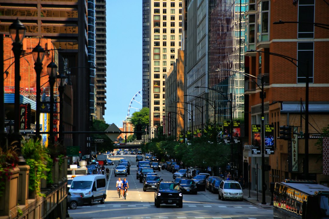
Ask a Chicagoan where they live and you will get a neighborhood. Ask the city, a census table, or a public health report, and you will get a community area. Those are not always the same answer, and the gap between them is where some of the best arguments in town happen.
There are 77 community areas. There are, by the Chicago History Museum’s count, more than 200 distinct neighborhoods.
The map a bunch of sociologists drew
The community areas came out of the University of Chicago. According to the Encyclopedia of Chicago, members of the university’s Local Community Research Committee wanted census data to reflect real divisions in the city instead of ward lines, which changed with every census.
The thinking came partly from sociologist Robert Park, who argued that physical barriers like rivers, parks, and railroads carved cities into “natural areas.” In the late 1920s, sociologists Ernest Burgess and Vivien Palmer mapped out 75 community areas, as UChicago News puts it.
Then the map grew twice. O’Hare was added in 1956 as Community Area 76. In 1980, Edgewater, in the Encyclopedia’s phrasing, “wrested a symbolic secession from Uptown” and became Community Area 77. Those are the only two new community areas since the original map, which is why the 77 make such handy yardsticks.
What the 77 are actually for
Community areas were built for counting. The University of Chicago Press published 1920, 1930, and special 1934 census data broken out by community area, and the Local Community Fact Book series kept that going after every census except 1970.
Because the boundaries barely move, they are great for comparing one decade to another. That is why you still see them everywhere in city data, and why the city keeps an official community area boundaries map on its data portal.
The catch is that the original researchers never meant them to be neighborhoods. UChicago professor Emily Talen, who ran a 2023 survey asking residents to draw their own neighborhood boundaries, has said the community areas “could very well be artifacts.” The Encyclopedia is blunter: they “do not necessarily represent how Chicagoans think about their city.” Its example is Pilsen, which lives inside the much less familiar name Lower West Side.
The city has a second map
Here is the part that surprises people. The city’s data portal also hosts a separate neighborhood boundaries map, with 98 areas, developed by the Office of Tourism. Its own description says the boundaries “are approximate and names are not official.”
So the city has an official map that everyone agrees is not how anyone talks, and an unofficial map that says, right on the label, that it is unofficial. Neither one is the map in your head.
Wicker Park, Bucktown, and the Bloomingdale question
Officially, neither name exists. WTTW notes that Wicker Park and Bucktown are part of the West Town and Logan Square community areas, respectively. The Encyclopedia puts West Town’s northern edge at roughly Bloomingdale.
That should settle it, and it does not. When Patch asked local groups in 2013 where one ends and the other begins, most pointed to Bloomingdale, but the Bucktown Community Organization’s bylaws claimed territory south to North Avenue. Even the Encyclopedia’s West Town entry talks about “the Bucktown section north of North Avenue.” Pick your side. Your landlord already did.
Lincoln Square, Ravenswood, and other family feuds
On the North Side, the official name is Lincoln Square, Community Area 4. But the Encyclopedia’s Lincoln Square entry notes that the Ravenswood subdivision, built after a rail flag stop opened in 1868, “was so influential that its name at one time stood for the whole area.” The Lincoln Square name got a push starting in 1949, when the local chamber of commerce began promoting it.
So if you say Ravenswood and your friend says Lincoln Square, you are both standing on history. Whether your block is one or the other is between you, your friend, and whoever is buying the next round.
You probably have your own version. Is it Uptown or Edgewater? Where does your neighborhood stop being your neighborhood? Most of these fights end at a major street, which is one more reason to learn Chicago’s address grid, so you can at least argue in exact numbers.
If you are choosing where to live
Listings love the fancier name, so a place advertised as Wicker Park might sit in an area other people call something else. Check the actual cross streets before you fall for a label. If you are weighing that corner of the city, a list of apartment buildings in Wicker Park, Bucktown and Logan Square is a decent place to see what is on which block.
Then go walk it. The fastest way to learn what a neighborhood calls itself is to buy a coffee or a paperback from the shop on the corner and see what name is painted on the window. One less Amazon order a week, and you come home knowing which side of the line you are on.
Where does your neighborhood end? Draw the line for us with #Chicago111.
Sources: Encyclopedia of Chicago: Community Areas; Encyclopedia of Chicago: Lincoln Square; Encyclopedia of Chicago: West Town; Chicago History Museum; UChicago News; UChicago Division of the Social Sciences; City of Chicago Data Portal: Community Areas; City of Chicago Data Portal: Neighborhoods; WTTW; Patch.
Photo: Bo Zhang / Unsplash
Like a place in this story? Go see them in person. One less Amazon order a week.
Leave a Reply