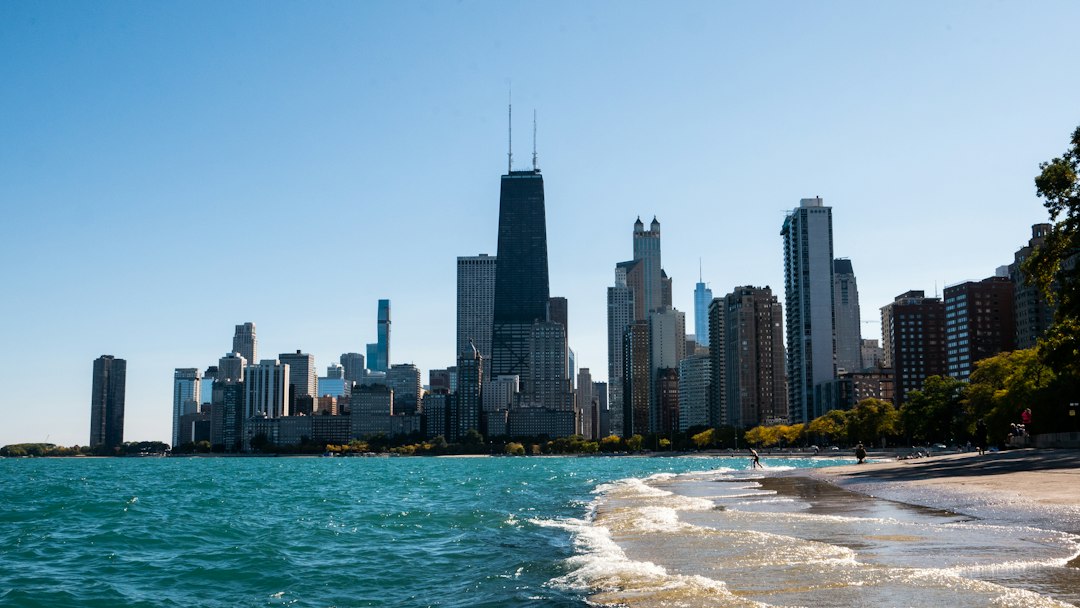
Somewhere in the Chicago area, a tomato plant is going to die this month, and somewhere else a few miles east, its cousin will keep going until November. The difference isn’t the gardener. It’s the lake.
Lake Michigan is the biggest weather-maker most of us never think about until the forecast says “cooler by the lake” for the fourth day in a row. It doesn’t just add a breeze. It shifts freeze dates, splits rain from snow, and decides which side of town digs out. Here’s how it works, and why it matters on your block.
The first freeze arrives about a month apart across the area
In his “Ask Tom Why?” column in November 2021, Tom Skilling laid out the spread for the first fall freeze: around Oct. 2 in the coldest outlying suburbs, Oct. 11 at O’Hare, Oct. 25 at Midway, and Nov. 5 in the Loop. That’s more than a month between the far suburbs and downtown, inside one metro area.
One caveat: the National Weather Service’s current normal first freeze for O’Hare, based on 1991–2020 data, is Oct. 19, not Oct. 11. The sources differ, and the NWS figure is the current official normal. The pattern holds either way: the closer you are to the water, the later the frost. The NWS record book shows how wide the range can be at O’Hare alone, from Sept. 22, 1995, to Nov. 24, 1931.
Chicago’s official temperature comes from O’Hare, not the lakefront
If the TV number never matches your balcony, this is part of the reason. Chicago’s official weather station has been at O’Hare since Jan. 17, 1980, according to the NWS Chicago office. Before that it was Midway (1942–1980), the University of Chicago (1926–1942), and a string of Loop rooftops going back to 1870, including the Auditorium tower.
So the city’s “official” high and low come from out by the runways, well away from the lake. On a June afternoon in Edgewater or a January night in South Shore, the lakefront can be living in a different forecast.
Cooler by the lake: April through June
WGN’s weather team puts the heart of “cooler by the lake” season in April through June. Water has a high specific heat, so the lake warms slowly in spring. On a warm day with light winds, air over land heats up and rises, and cooler, denser air over the lake slides in to replace it. That’s the lake breeze.
It’s not subtle. On June 12, 2025, for example, FOX 32 forecast mid-80s inland while the lake-cooled air kept lakeside temperatures in the 70s. Every Chicagoan has lived some version of this: shorts at lunch in the West Loop, a jacket by the time you walk to the lakefront path. Wind direction decides how far inland the cool air gets, which is why some days it stops at Lake Shore Drive and other days it rolls well into the neighborhoods.
Warmer by the lake: October into winter
Now flip it. The same slow-to-change water that chilled May afternoons is holding summer’s heat into fall. When the lake is warmer than the air and the wind blows onshore, it carries that warmth inland. That’s the reason for the late Loop freeze, and the reason late-fall storms can drop rain near the lake while wet snow piles up in the outer suburbs, as both WGN and Skilling have described.
If you just moved here from somewhere with a single forecast for the whole city, this takes some getting used to. “Rain changing to snow inland” is a real sentence, and it may describe the difference between your apartment and your office.
Lake-effect snow often lands next door
Lake-effect snow happens when cold air moves over relatively warm, unfrozen lake water, the NWS explains: heat and moisture rise, clouds build, and the wind pushes the snow onto land in narrow bands. Illinois State Water Survey researchers have found it typically affects areas 10 to 30 miles downwind of the lake.
Downwind is the key word. In the two most recent big events, the heaviest totals landed outside the city, in the far north suburbs and northwest Indiana. On Nov. 9–10, 2025, WTTW’s totals showed 10 inches in Winthrop Harbor and 11.3 in Cedar Lake, Indiana, while West Ridge got 3.5, Midway 2.5 and O’Hare 1.6. In January 2024, the NWS reported about a foot in northeast Porter County, Indiana, and closer to three feet farther east.
Chicago does get its turn. During the February 2011 blizzard, northeast winds let the lake add to an already huge storm: NOAA totals cited by the Illinois State Water Survey showed 20 to 24 inches within about 25 miles of the lake, compared with 12 to 15 inches on the outskirts.
What it means on your block
- Gardeners: a lakefront balcony and a yard out by O’Hare are on different frost calendars. Watch the overnight low for your area, not the official number.
- Commuters: dress for where you’ll be at 5 p.m., not where you are at 8 a.m. In spring, that usually means one more layer if you’re headed east.
- Snow days: a lake-effect band can bury one neighborhood and skip the next. If friends across town are shoveling and you’re not, that’s not luck. That’s geometry.
- Bigger picture: the lake shapes more than the weather. It’s the reason the city reversed its river, which we covered in Why the Chicago River Runs Backward.
And since Chicago weather is famously hyperlocal, it’s worth knowing where your own neighborhood’s lines fall. Our guide to community areas and neighborhoods is a good place to start. When the first real band of snow shows up, the neighborhood hardware store will have the shovel and the salt today. The delivery van might make it Thursday.
Is your side of town cooler by the lake or warmer by the lake right now? Post your forecast-versus-reality photos with #Chicago111.
Sources: WGN, Tom Skilling (Nov. 2021); NWS Chicago, first freeze; NWS Chicago, observation site history; WGN (May 2024); FOX 32 (June 2025); NBC Chicago (Nov. 2025); WTTW (Nov. 10, 2025); NWS Chicago, 2023–24 winter events; Illinois State Water Survey (Feb. 2011).
Photo: Dylan LaPierre / Unsplash
Like a place in this story? Go see them in person. One less Amazon order a week.
Leave a Reply